Lehigh Gorge: 26 Miles of Gravel, One Train Ride Up
The D&L Trail, the Bike Train, and the Lehigh River. Here's how to bike Lehigh Gorge State Park.
Key Takeaways
- The “26-Mile Glide”: The southern 26 miles of the D&L Trail is almost entirely a gentle downhill grade. Use a shuttle service from Jim Thorpe to White Haven, and you can coast back down to town with minimal pedaling.
- Glen Onoko Warning: The trail to the upper Glen Onoko falls is PERMANENTLY CLOSED and strictly enforced. DCNR rangers issue substantial fines ($250+) to anyone caught past the closure signs. Stick to the river-level falls instead.
- The Waterfall Shortcut: If you only have 30 minutes, park at the Rockport Access. Buttermilk Falls is a 2-minute walk north on the bike path, and Luke’s Falls is a 5-minute walk south.
- The Bike Train: For the ultimate experience, take the Lehigh Gorge Scenic Railway bike train from Jim Thorpe to White Haven. It’s expensive and sells out weeks in advance. Book early at
lgsry.com.- Wilderness Corridor: The gorge is a remote wilderness with zero services between White Haven, Rockport, and Jim Thorpe. Carry a patch kit, plenty of water, and a snack for the 2-4 hour ride.
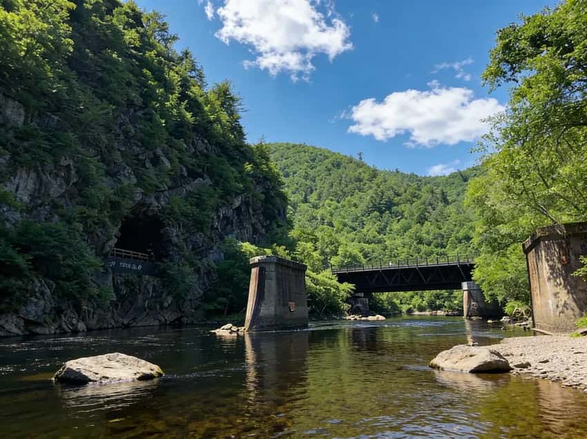
Lehigh Gorge State Park used to be about dangerous waterfall climbing. Today, it is Pennsylvania’s premier destination for long-distance, gravity-assisted cycling. The park protects a 26-mile wilderness corridor where rafters, vintage trains, and cyclists share the deep, narrow gorge of the Lehigh River.
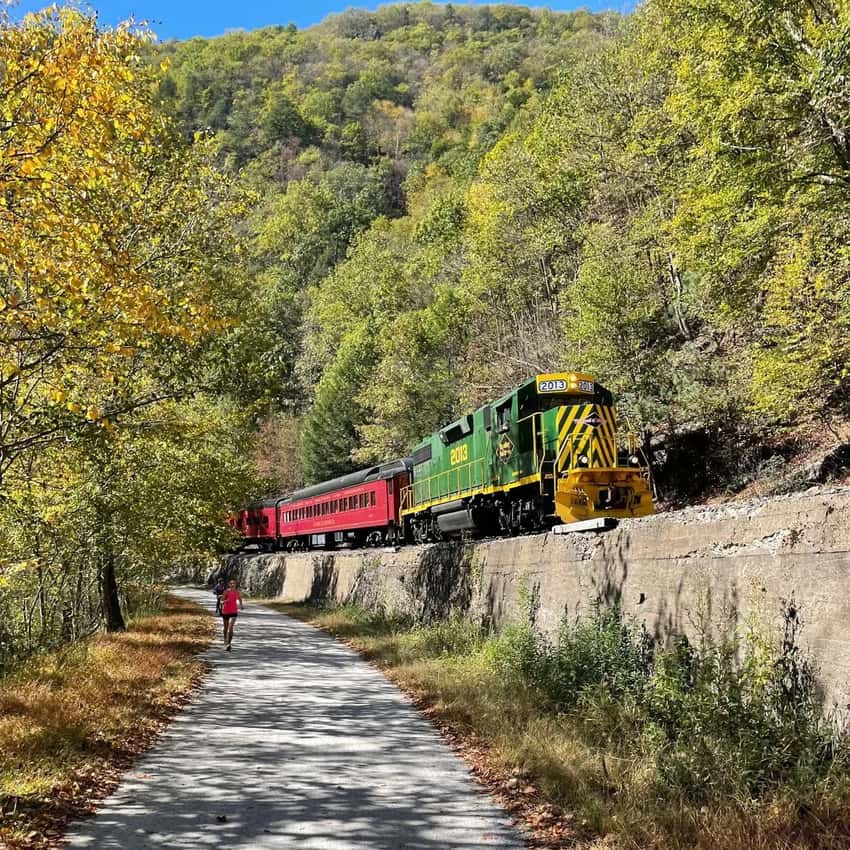
The D&L Trail runs 26 miles through the gorge on crushed stone, downhill from White Haven to Jim Thorpe. On summer weekends, it’s a biking highway. You can shuttle up in a van, or you can take the Bike Train - load your bike onto a vintage train, ride to White Haven, and coast back down. Either way, you’re not hiking to waterfalls anymore.
The 26-mile Lehigh Gorge Trail is part of the 165-mile D&L Trail system. Visit the PA DCNR site for trail updates and check AllTrails for current conditions.

The D&L Trail - 26 miles of crushed stone through the gorge
Glen Onoko Falls is Closed (Don’t Try It)
Why It’s Closed
Glen Onoko Falls has been closed since May 1, 2019. Eight people died on the trail between 1977 and 2019. The terrain is steep, rocky, and eroded. The Pennsylvania Game Commission, which manages the land, closed it permanently due to safety concerns and the strain on emergency services.
The Fine
If you trespass, you’ll be fined $100-200. Rangers patrol the area regularly. People who ignore the closure and need rescue get ticketed heavily.
Alternative
Visit Buttermilk Falls near the Rockport Access. It’s a tall cascade you can see right from the parking area - no fines attached.
The D&L Trail (The Main Event)
The Delaware & Lehigh Trail runs 26 miles through Lehigh Gorge State Park, from White Haven to Jim Thorpe. It’s a crushed stone rail-trail that follows the Lehigh River. The grade is flat with a gentle downhill slope toward Jim Thorpe (2% grade).
How to Ride It
You have three options:
- Shuttle Service: Drive to Jim Thorpe, park, and take a shuttle (Pocono Bike Rentals, Lehighton Outdoor Center) to White Haven. Bike back down (25 miles, 2-4 hours).
- The Bike Train: Load your bike onto the Lehigh Gorge Scenic Railway in Jim Thorpe, ride the train to White Haven, and bike back. It’s the coolest option but runs on select weekends and requires reservations.
- Out-and-Back: Park at Rockport Access (midpoint) and ride in either direction.
What to Expect
- Surface: Crushed stone (gravel). Road bikes with skinny tires will struggle. Bring a hybrid or mountain bike. Fat bikes and e-bikes work great
- Grade: Technically “downhill” from White Haven to Jim Thorpe (2% grade), but you won’t notice much. It feels flat. Return trips uphill are noticeable over 26 miles
- Crowds: Very busy on weekends (100+ cyclists). Summer peak season is packed. Spring and fall weekdays are quieter. Watch for families and slower riders taking up the whole trail
- Wildlife: Rattlesnakes are common along the trail, especially in summer. Stay on the path. Other wildlife includes deer, foxes, bald eagles (winter)
- River Views: The Lehigh River is rarely visible from the trail (too many trees), despite the proximity. You’re more aware of the gorge from the sound of water
- Time Reality: 26 miles takes 2-4 hours depending on pace and stops. A leisurely ride with photo stops takes 4-5 hours
- Skill Level: This is beginner-friendly. No technical terrain, no elevation challenges. Families with kids do this regularly
- Bathrooms: Limited facilities. Pocono (mile 6) has options. Pack for the ride
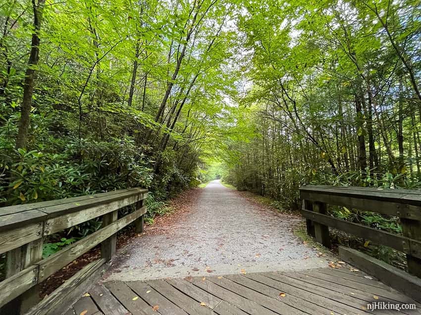
Bike Recommendations: Hybrid bikes (comfort/speed balance) are ideal. Mountain bikes work but are slower. Gravel bikes are perfect. Road bikes are frustrating on crushed stone
The Lehigh River (Rafting on Dam Release Days)
The Lehigh River runs alongside the D&L Trail. Rafting is only possible on scheduled dam release weekends (May-October) when the Francis E. Walter Dam releases water.
- Rapids: Class II-III (fun but not insane).
- Outfitters: Pocono Whitewater, Jim Thorpe River Adventures.
- Note: You cannot just “tube” the gorge freely like the Delaware. You need a shuttle or a structured trip.

Parking and Access Points
Jim Thorpe (Southern Access)
- Parking: Large municipal lot (paid, fills by mid-morning on weekends).
- Vibe: Tourist town. Restaurants, bike shops, train station.
- Best For: Starting or ending your ride (if you shuttle).
Rockport Access (Midpoint)
- Parking: Free, but fills by mid-morning.
- Best For: Shorter rides or accessing Buttermilk Falls.
White Haven (Northern Access)
- Parking: Free.
- Best For: Starting point if you’re shuttling yourself or taking the Bike Train.
What You Need to Know Before You Go
Don’t Bring a Road Bike
The crushed stone surface is rough. Road bikes with skinny tires struggle. Bring a hybrid or gravel bike.
The Bike Train Sells Out
The Lehigh Gorge Scenic Railway runs on select weekends and requires reservations. Book ahead.
Rattlesnakes Are Real
They’re common on the trail, especially in summer. Stay on the path.
Insider Tips
Bike Train Strategy: The Lehigh Gorge Scenic Railway Bike Train is the most fun way to do this ride, but it’s expensive (~$60-80) and only runs select weekends. Book 2-3 weeks ahead. It’s worth the splurge once, but shuttle services are more flexible for repeat visits.
Shuttle vs. Self-Shuttle: Hiring a shuttle service is easiest. But if you have two cars or friends, self-shuttling saves money.
Drive one car to Jim Thorpe, park, drive the other to White Haven. Ride back to Jim Thorpe and retrieve the first car.
Peak Season Reality: Summer (June-August) weekends are crowded with families. Spring (April-May) and fall (September-October) are ideal, good weather and fewer cyclists. Weekdays are always quieter.
Rattlesnake Reality: Timber rattlesnakes are present but encounters are rare if you stay on the trail. Make noise while riding (they’ll move away). Don’t hike off-trail into tall grass.
Bike Rental Decision: Renting is smart if you don’t have a hybrid/gravel bike. Local shops rent quality bikes for $30-50/day. Bring your own if you have one, rentals can be hit-or-miss quality.
Buttermilk Falls Alternative: If you want waterfall photos, park at Rockport Access and walk 5 minutes to Buttermilk Falls (visible from parking). It’s an easy add-on to any D&L ride.
Rafting Timing: Rafting only works on scheduled dam release weekends (May-October). Check the Francis E. Walter Dam schedule before planning a water adventure. Spring (April-May) has the most water releases.
Fall Foliage Timing: Peak foliage is September 25-October 15. The trail itself has fewer trees (it’s a corridor), but surrounding ridges are colorful. Bike Train offers special foliage tours with premium pricing.
What to Bring for the Bike Ride
Hydration and Food
Pack more water than you think you need. There are zero services between White Haven, Rockport, and Jim Thorpe, so a 26-mile ride with nothing to drink is a genuinely miserable experience. Carry at least two large water bottles or a hydration pack, and bring snacks (energy bars, trail mix, sandwiches) to keep your energy up. A small cooler bag strapped to a rack works well if you want a proper lunch stop at Rockport.
Repair Essentials
A flat tire in the gorge means a long walk. At minimum, bring a spare tube, a hand pump or CO2 inflator, and a multi-tool. Crushed stone punctures tires less often than it used to, but it still happens, especially in spring when sharp gravel washes across the path after rain. If you’re renting a bike, ask the shop if they include a basic repair kit, because some do and some don’t.
Clothing and Safety Gear
A helmet is non-negotiable, and most rental shops require one anyway. Wear padded bike shorts or at least comfortable athletic pants since even a gentle 26-mile ride gets uncomfortable without padding. Bring a light rain jacket even on sunny days, because weather in the gorge changes quickly and trees provide limited shelter. Sunscreen matters more than people expect here, since the trail corridor is open sky for long stretches.
What to Rent vs. Bring
Rent a bike if you don’t own a hybrid, gravel, or mountain bike. Road bikes with skinny tires (23c-25c) are genuinely frustrating on crushed stone. Local shops in Jim Thorpe rent quality hybrid and mountain bikes for $30-50/day, and renting a bike plus reserving a shuttle slot from the same shop simplifies logistics considerably. Bring your own helmet if you have one, because rental helmets vary in fit and comfort.
Accessible Hiking Options
Not everyone visiting Lehigh Gorge wants to spend three hours on a bike. The park has several options for visitors who prefer walking, and some of them put you right next to the best scenery in the gorge.
Walking the D&L Trail (Flat and Paved-Adjacent)
The D&L Trail through the gorge is crushed stone and flat, which makes it walkable for most fitness levels. You can park at Rockport Access and walk north or south on the trail without committing to the full 26 miles. A one-mile out-and-back in either direction from Rockport gives you river sounds, tree canopy, and the feeling of the gorge without any elevation gain. Strollers and wheelchairs with wider tires can manage the surface on dry days, though the crushed stone is not ideal for standard wheelchair wheels. [SOURCE NEEDED: official ADA accessibility rating for the Rockport section]
Rockport Access and the Waterfall Walk
The Rockport Access is the easiest place in the park to see waterfalls without biking or serious hiking. Park for free, walk two minutes north on the trail to reach Buttermilk Falls, a tall cascade that drops directly into view from the path. Walk five minutes south instead and you reach Luke’s Falls. Both are flat walks on the main trail surface, and both are worth the visit even if you never touch a bike.
Remembering Glen Onoko
If you’re visiting because you remember hiking Glen Onoko before the 2019 closure, the honest answer is there is no equivalent replacement inside the park. The river-level portion near the old trailhead is sometimes accessible as a flat walk, but the upper falls trail is fully closed and patrolled. Buttermilk Falls is the best waterfall substitute currently available inside the park boundary.
Photography Tips
Best Light in the Gorge
The gorge runs roughly north-south, and the canyon walls block direct sunlight for most of the day. Overcast days are actually better for photography here than bright sunny days, because harsh shadows disappear and the green of the forest pops without blown-out highlights. If you want direct light on the river, arrive at Rockport around midday when the sun is high enough to clear the ridge on both sides.
Waterfall Angles at Buttermilk Falls
Stand on the trail and shoot perpendicular to the falls for the cleanest frame. A wide angle lens (or phone on wide mode) captures the full height of the drop plus the surrounding trees. Shoot from the lower position on the trail for a more dramatic upward perspective. Early morning after rainfall produces the most water flow and the most interesting foreground detail in the pools below.
Stopping Points Along the Trail
The trail doesn’t offer many dramatic river overlooks because trees line the corridor tightly. The best views come at the handful of open cuts where the gorge widens slightly, usually near old dam remnants or access paths to the river. Keep your phone or camera accessible rather than packed away, because the best shots often appear for thirty seconds before the corridor closes back in. The bridge crossings along the route offer clear sightlines up and down the river and are worth a brief stop.
Capturing the Bike Train
If you’re riding the Lehigh Gorge Scenic Railway, the train moves slowly enough through certain sections that you can shoot out the window without motion blur. The view from the train looking toward the gorge walls above White Haven is one of the more dramatic angles in the park. On the return bike ride, look back uphill at the trestle bridges that the train crosses, those structures photograph well from below when lit by afternoon light.
Best Time to Visit
- Spring: Buttermilk Falls flowing. Fewer crowds. Wildflowers along the trail.
- Summer: Peak season for biking and rafting. The trail is packed on weekends. Hot days but good water for swimming
- Fall: October foliage on surrounding ridges is spectacular. Bike Train offers foliage tours. Cooler temperatures make riding more comfortable
- Winter: Trail is open but muddy/icy. Not ideal for biking. Cross-country skiing possible on snow
FAQ
Is Glen Onoko Falls open? No. It’s been closed since May 2019 and will not reopen soon. Rangers actively patrol the area and issue fines to anyone caught past the closure signs. Buttermilk Falls at Rockport is the best alternative currently inside the park.
Is the trail paved? No. It’s crushed stone (gravel). Road bikes with narrow tires will struggle. Bring a hybrid, gravel, or mountain bike, or rent one from a shop in Jim Thorpe.
How long does the bike ride take? 26 miles from White Haven to Jim Thorpe takes 2-4 hours for most riders at a casual pace. Add an extra hour if you plan to stop for photos, snacks, or exploring the Rockport area at the midpoint.
Can you swim in the river? Not safely. The currents are strong, and there are no designated swimming areas. Rafting on scheduled dam release weekends is the organized way to get on the water.
Do I need to make reservations for the shuttle? It depends on the time of year. On peak summer weekends, shuttle services fill up, and showing up without a reservation can mean waiting or getting turned away. Book your shuttle and bike rental together at least a week in advance from June through August.
Is the park dog-friendly? Dogs are allowed on the D&L Trail if kept on a leash. The trail surface is friendly for most dogs, though the crushed stone can wear on paw pads over a full 26-mile ride. [SOURCE NEEDED: official DCNR dog policy for Lehigh Gorge State Park] Carry water for your dog because there are no water sources along the corridor between access points.
What happens if I get a flat tire or mechanical issue on the trail? You handle it yourself or walk out. There are no services in the gorge between White Haven, Rockport, and Jim Thorpe. Carry a spare tube, pump, and multi-tool. If you’re completely stuck, Rockport Access (around mile 13) is your best bail-out point, as it connects to a road.
Explore More
Nearby Biking & Activity Spots:
- Hickory Run State Park (20 minutes): Boulder Field hiking and waterfall trails. Pair with D&L Trail for a two-activity day
- Delaware Water Gap National Recreation Area (30 minutes): Similar gorge hiking, river access, and more waterfall options
- Lehigh Valley Trail (Local): Extensions of the D&L Trail in both directions for longer cycling trips
Regional Guides:
- Full Poconos region guide for more waterfall, hiking, and outdoor recreation
- PA State Parks complete list for other gorge and rail-trail biking destinations
Similar Experiences:
- Schuylkill River Trail (Phoenixville to Reading): 60 miles of rail-trail biking in eastern PA
- Lackawanna Coal Heritage Trail: Historic rail-to-trail in northeast PA with similar crushed-stone surface
- Susquehanna Riverlands Trail: Extensions of the D&L system in adjacent counties