Gifford Pinchot State Park: Alpine Trail Bluebells & Lakeside Loop
The bluebell capital of York County. A 0.5-mile wildflower connector and an 8.5-mile lakeside loop with 2026 bridge detour intel.
Key Takeaways
- Bluebell Timing: The Alpine Trail is world-class for exactly 10-14 days in late April and early May. Outside this window, the trail is a standard forest path. Call the park office in mid-April to time your visit to the peak bloom.
- The “A-Loop” Strategy: If you are camping, aim for sites A1 through A15 on the 90-site peninsula. These offer direct water access and unobstructed sunset views over the lake.
- Disc Golf Warning: Gifford Pinchot is home to Quaker’s Challenge, one of the most difficult disc golf courses on the East Coast. If you aren’t a pro, stick to the Boulder Course on the east side of the park for a more enjoyable afternoon.
- Lakeside Trail Hack: The full 8.5-mile loop is a major commitment. For the best “bang for your buck,” hike the section between Conewago Day Use Area and the Sunnyside Pavilion, the most scenic stretch and mostly flat.
- Boat Rental Tip: Skip the busy Mooring Area for boat rentals. Use the Conewago Day Use Area rental station; it usually has shorter lines and immediate access to the quieter northern finger of the lake.
Gifford Pinchot State Park is a 2,338-acre multi-use hub centered around a massive lake in York County. While it’s famous for its seasonal spring wildflowers, it functions year-round as the region’s premier destination for camping, tournament-grade disc golf, and long-form lakeside hiking.
But Gifford Pinchot is more than a seasonal photo stop. The park offers an 8.5-mile Lakeside Trail loop around a substantial lake, with options for mountain biking, paddling, and casual walking. This guide will show you how to time the bluebell bloom, navigate 2026 bridge construction, and experience the park beyond wildflower season.
The Alpine Trail: The Bluebell Shortcut
This is the defining hike at Gifford Pinchot. A brief 0.5-mile walk to peak wildflower viewing.
The Hike
Distance: 0.5-1 mile out-and-back (depending on how far you venture)
Elevation Gain: 100 feet
Difficulty: Easy. Flat to gently rolling.
Trailhead: Alpine Road parking area (GPS: 40.2889, -76.7722). This is the dedicated wildflower-viewing parking area. It’s smaller and more crowded during peak bloom (late April-early May).
Trail Type: Dirt and gravel path. No water sources. Well-maintained.
Season: Late April through early May is the ONLY season that matters here. This is when bluebells peak. The rest of the year, the trail is forgettable.
Bloom Peak: Typically April 20-May 15. Peak bloom (maximum flower density) usually occurs around May 1-May 10. Spring timing varies by 1-2 weeks depending on weather.
Time: 20-30 minutes for the walk out to peak bloom zone. Most people spend 30-60 minutes photographing.
What to Expect
The Bluebells: In peak bloom (late April-early May), the Alpine Trail is carpeted with Virginia bluebells (Mertensia virginica). The flowers are delicate, blue, and densely packed in the understory. From a distance, entire hillsides appear solid blue. This is a genuine botanical spectacle.
The Marsh Marigolds: Simultaneously, yellow marsh marigolds bloom alongside the bluebells, creating a blue-and-gold palette. The color contrast is striking.
Crowds: Peak bloom (late April-early May) is extremely busy. Weekends during this 3-week window see parking lots full by 9 AM. Weekday mornings are quieter. Photography enthusiasts arrive at 7 AM to beat crowds and capture golden light.
Photography Reality: The Alpine Trail is a photography destination during peak bloom. Expect crowds of people with cameras, tripods, and phone cameras. The iconic shot is looking down a slope of blue wildflowers with trees in the background. Wide-angle lens (16-35mm) captures the full bloom carpet.
Early morning light (6-8 AM) is golden and warm. Midday light is harsh.
Off-Season Reality: After May 15, the wildflowers fade quickly. By June, the Alpine Trail is just a regular forest path with no florals. It becomes indistinguishable from thousands of other woodland walks. Don’t hike this trail except during peak bloom.
Timing: Exact peak bloom shifts 1-2 weeks depending on spring weather. Early warm springs (Feb-March) = earlier bloom. Late springs (slow melt) = later bloom. Check local wildflower reports or call the park office to confirm current peak bloom dates in late April.
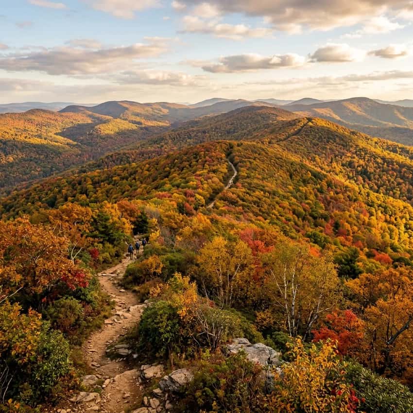
The Lakeside Trail Loop: The Full Experience
When bluebells fade, the Lakeside Trail becomes the main attraction.
The Hike
Distance: 8.5-mile loop (around the lake perimeter)
Elevation Gain: 600+ feet (constant rolling terrain with multiple climbs)
Difficulty: Moderate. Not flat despite being a “loop.” Frequent elevation changes. Rocky and rooted terrain.
Trailhead: Quaker Race Day Use Area parking (GPS: 40.2778, -76.7805). This is the main park parking and trail access point.
Trail Type: Dirt, rocks, roots. Rocky in sections. Can be muddy depending on recent rain and season. Multi-use trail (hikers, mountain bikers, runners).
Season: September-October (fall foliage, firm ground, comfortable temps) is best. Spring (March-May) is muddy and unreliable. Summer is hot and humid.
Time: 3-4 hours for fit hikers. Slower hikers 4-5 hours.
What to Expect
The Lake: You’re circumnavigating a substantial lake (Conewago Creek Reservoir). Water views are frequent but not constant, the trail winds through woods alongside the water, not always directly on shore.
Rocky Terrain: The trail is notoriously rocky. Loose rocks, embedded boulders, root systems. Hiking boots are essential.
Trail runners will slide. Trekking poles recommended.
Elevation Changes: The loop includes several significant climbs (each 150-200 feet). No flat sections exist. Your legs will feel this.
Beaver Activity: Beavers are active throughout the park. Their dams create wet areas, muddy sections, and water level fluctuations. Spring (March-May) sees high water and muddiness, trails can be impassable in sections. Fall is more reliable.
Wildlife: Deer frequent the loop. Bird activity is high in spring (migration) and fall. Occasional reports of black bears, though sightings are rare.
Crowds: Moderate on weekends, especially fall. Multi-use trail means hikers share space with mountain bikers (who are usually faster and respectful). Weekday mornings are quieter.
Photography: The lake is most photogenic in fall (foliage reflected on water) and golden hour (sunrise 6-7 AM, sunset 5-6 PM). Wide-angle lens captures water and surrounding ridge. Telephoto isolates wildlife.
Partial Loop Options
Doing the full 8.5 miles is ambitious. Consider these shorter alternatives:
Half Loop (4-4.5 miles): Hike to the halfway point (usually marked), return the same way. Reduces distance and commitment while still experiencing the lake.
Spur Trails: Several short spurs branch from the main loop to viewpoints and camping areas. Doing the main loop plus 1-2 spurs gives a personalized experience.
2026 Access Warning: Route 74 Bridge Closure
CRITICAL: The Route 74 (Carlisle Road) bridge closure runs January 12-September 9, 2026. This is the main highway access to the park. Construction will create delays and traffic.
The Problem
Route 74 is the primary highway connecting Lewisberry to the park. The bridge is undergoing replacement. The closure spans 9 months. During this period, expect:
- 10-20 minute delays on Route 74
- Heavier traffic on alternate routes
- Possible construction vehicle activity
- Continued closure through summer peak season
The Solution: Harmony Grove Road Detour
Use Harmony Grove Road as your alternate route.
Directions: From Lewisberry, take Route 72 north, turn onto Harmony Grove Road (watch for signs), follow it east to the park entrance. This route adds approximately 5-10 minutes compared to Route 74 direct access, but avoids sitting in construction traffic.
Alternate Route: You can also approach from the north via Route 39 or the south via Route 441. Check current traffic and construction status before leaving.
Travel Timing
If visiting during peak wildflower season (late April-early May) when both the park and construction are at maximum, go on a weekday morning. Avoid weekends. Use the Harmony Grove Road detour to skip construction congestion.
Spring Versus Fall: A Comparison
Spring (April-May): Wildflower Focus
Best For: Alpine Trail bluebells (late April-early May only)
Hiking Conditions: Muddy. High water. Beaver dams create impassable sections on Lakeside Trail.
Weather: 55-70°F. Cool mornings, warmer afternoons.
Crowds: Busy during peak bloom (late April-early May). Lighter before/after bloom window.
Access: Route 74 bridge closure impacts March-May. Use Harmony Grove Road detour.
Recommendation: Come specifically for bluebells (late April-early May), hike the short Alpine Trail only, accept mud if doing Lakeside Loop. Don’t expect reliable conditions on the full loop.
Fall (September-October): Full Park Experience
Best For: Comfortable hiking temps, firm ground, foliage, full Lakeside Loop
Hiking Conditions: Dry, well-defined trails, firm ground. This is when the park shines for distance hikers.
Weather: 60-75°F. Crisp mornings, comfortable afternoons.
Crowds: Busy on weekends (foliage season), moderate on weekdays.
Access: Route 74 should be reopened by September 9. Normal access restored.
Recommendation: If you want to hike the full 8.5-mile Lakeside Loop, come in fall. The trail conditions are superior, and the experience is more rewarding.
Mountain Biking & Paddling
Beyond hiking, Gifford Pinchot supports other recreation.
Mountain Biking
The Lakeside Trail is multi-use and suitable for mountain bikes. The rocky terrain and elevation changes appeal to intermediate-to-advanced riders. Fall (September-October) is best for trail conditions.
Kayaking & Paddling
The lake allows kayaks and small boats. Boat rental options may be available seasonally (check with park office). Paddling the lake offers a water-based perspective of the surrounding ridges.
Fishing
The lake is stocked with bass, pickerel, and panfish. Fishing piers are accessible. A PA fishing license is required ($26.97 for 7 days).
Photography Tips
Best Bluebell Shot: Early morning (6-7 AM) during peak bloom (late April-early May). Golden hour light on blue wildflowers creates rich color saturation. Wide-angle lens (16-35mm) captures the bloom carpet. Shoot from a low angle to emphasize the density of flowers.
Best Lake Shot: Golden hour (sunrise 6-7 AM or sunset 5-6 PM) from a shoreline vantage point. The lake surface reflects light beautifully. Fall foliage (Sept 25-Oct 15) surrounding the lake provides colorful backdrop. Telephoto lens (70-200mm) isolates calm water and distant ridge.
Best Wildflower + Tree Composition: Shoot with both wildflowers in foreground and trees in background to show scale and context. The Alpine Trail offers these layered compositions naturally.
Best Fall Foliage: Late September through early October (peak color varies by weather). Shoot from elevated sections of the Lakeside Trail looking down at the lake with colored ridge backdrop. Early morning or late afternoon side-lighting emphasizes foliage color saturation.
Insider Tips
Bluebell Timing: Peak bloom is typically May 1-10 but varies by spring weather. Call the park office 1 week before your planned visit to confirm current bloom status. Don’t show up hoping for bluebells without confirmation.
Alpine Trail Crowds: Arrive before 8 AM on weekdays during peak bloom to avoid crowds and get better photography light. Weekends are packed 9 AM-3 PM.
Lakeside Trail Strategy: For a challenging full day, hike the loop in fall. For casual walks, do partial loops or shorter spurs. The full 8.5 miles is ambitious. Many hikers prefer 4-5 mile half-loops.
Route 74 Detour: Use Harmony Grove Road to bypass construction. It’s only 5-10 minutes longer but avoids sitting in traffic. Plan extra time on weekdays during peak season.
Spring Mud Reality: If you do the Lakeside Loop in spring (April-May), expect muddy conditions and possible beaver dam blockages. Go in fall for reliable hiking conditions.
Wildflower Photography Etiquette: Stay on marked trails when photographing bluebells. The plants are fragile. Don’t trample flowers for “better” camera angles. The ethical approach yields better light and composition anyway.
Beaver Watch: Keep eyes open for beaver activity, dams, chewed trees, wood lodges. The beavers have shaped park hydrology significantly. Their presence is part of the ecological story.
Best Time to Visit
Late April-Early May: For Alpine Trail bluebells specifically. Short visit focus on wildflowers only. Accept spring mud if doing Lakeside Trail.
September 25-October 15: Peak foliage + firm ground + comfortable temps. Best season for full park experience and Lakeside Loop hiking.
June-August: Hot, humid, lower water levels. Wildflowers gone. Acceptable but not ideal.
November-March: Cold, muddy, sparse blooms. Not recommended unless doing winter activities.
FAQ
When exactly do bluebells bloom? Late April through early May, typically peaking May 1-10. Varies by spring weather. Call the park office to confirm current bloom status.
Is the Lakeside Trail dog-friendly? Yes, dogs on leash are allowed on park trails.
Can you camp at Gifford Pinchot? Yes, the park has campsites. Reservations available through PA State Parks system.
Is Route 74 closed? Yes, January 12-September 9, 2026. Use Harmony Grove Road detour.
What counties are visible from park overlooks? York and Lancaster counties primarily. On clear days, views extend to Dauphin and Berks.
Can you swim? No, swimming isn’t permitted in Gifford Pinchot. The lake is for fishing and boating only. Check if day-use beach areas exist (policies vary).
Explore More
Nearby Wildflower & Spring Hikes:
- Hawk Mountain Sanctuary (40 minutes): Raptor migration and ridge walking. Spring wildflowers along trails.
- Valley Forge National Historical Park (45 minutes): Mount Joy and Mount Misery wooded trails with spring wildflowers.
- Delaware Water Gap (60 minutes): Larger park with diverse spring ecology and waterfall hiking.
Other York County Trails:
- Duncannon Hawk Rock (20 minutes): Steep AT terrain with Susquehanna River views. Contrast to Gifford’s lake focus.
- Governor Dick Mt. Gretna (25 minutes): Tower views and bouldering. Similar “post-hike tradition” culture.
- Chickies Rock Overlook (30 minutes): Easy overlook walk with river views.
Regional Guides:
- Full South Central PA region guide for comprehensive Harrisburg area hiking options
- Best Hikes Near Harrisburg for additional York County trail options
Similar Spring Wildflower Destinations:
- Bowman’s Hill Wildflower Preserve, PA: Dedicated wildflower sanctuary north of Philadelphia (45 minutes away)
- Jenkins Arboretum, PA: Spring flower displays near Chester (90 minutes away)
- Wildflower Center, TX: Larger destination for year-round wildflower focus (far but comprehensive)
Gifford Pinchot is a seasonal destination. Visit in late April or early May specifically to experience the Alpine Trail bluebell bloom, it’s a genuine botanical spectacle that justifies the trip. The short 0.5-mile walk makes it accessible to families and casual visitors.
If you return outside wildflower season, tackle the full 8.5-mile Lakeside Loop in fall (September-October) when trail conditions are optimal and foliage is colorful.
Time your visit intentionally. Gifford Pinchot rewards planning.