Governor Dick Mt. Gretna: Tower Views & Boulders
A 1.5-mile hike to a 66-foot observation tower with panoramic five-county views. Plus the Jigger Shop, the ice cream stop many hikers make afterward.
Key Takeaways
- Navigation: Use the Pinch Road Lot (Google Maps | Apple Maps). This 1.5-mile round-trip is the most direct route to the tower. GPS: 40.3295, -76.3945.
- The Tower is the draw: A 66-foot concrete observation tower offers panoramic views of five Pennsylvania counties (Lebanon, Lancaster, Dauphin, Berks, York) from the summit platform.
- Bouldering: The park has a local bouldering scene; check current park rules before bringing pads.
- The Jigger Shop: A common post-hike stop for ice cream, in downtown Mount Gretna.
- Fall is peak season: September-October offers the clearest tower views and comfortable hiking temperatures.
Governor Dick Park, officially Clarence Schock Memorial Park, sits in Mt. Gretna as a 1,105-acre forested preserve built around a single feature: a 66-foot observation tower. It’s a staple of Harrisburg area hiking. The hike is short (1.5 miles round trip from Pinch Road), moderate in difficulty, and family-friendly. The reward is a panoramic view of five counties from the tower platform.
But Governor Dick isn’t just about tower views. The park surrounds the tower with bouldery terrain, a local bouldering scene, and historic Mount Gretna culture. This guide will get you to the tower, show you the rock formations, and point you to the Jigger Shop for ice cream afterward.
The Tower Trail: The Main Event
The Hike
Distance: 1.5 miles round trip (from Pinch Road parking)
Elevation Gain: 200 feet
Difficulty: Moderate. The climb is steady but short. Rocky footing throughout.
Trailhead: Pinch Road parking area, Mt. Gretna PA (GPS: 40.3295, -76.3945). This is the shortest, most direct route to the tower. Do NOT take the longer Environmental Center route unless you want extra distance.
Trail Type: Rocky, forested path. No water sources. Boots essential.
Season: Fall (September-October) is ideal for tower views and comfortable temperatures. Summer heat is oppressive on exposed sections. Winter is frozen and icy.
Blazes: Blue blazes mark the main trail clearly.
What to Expect
The Rocky Reality: This trail is rocky. The footing is uneven throughout, with scattered boulders and root systems. Hiking boots are non-negotiable. Light sneakers or trail runners will leave your ankles sore.
The Climb: 200 feet of elevation gain in 0.75 miles feels relentless. The trail climbs at a consistent grade, no flat sections. Your quads will feel it on descent.
The Tower: A 66-foot concrete structure. The interior has a metal spiral staircase. The climb to the top platform is tight and steep (66 feet of vertical), but manageable for anyone with basic fitness.
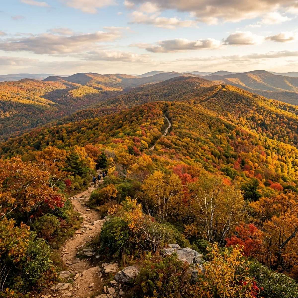
The View: From the platform, you’re looking out across five Pennsylvania counties. On clear days (fall is best), you see Lancaster County farmland to the southeast, Lebanon County ridgelines to the north, Dauphin County to the east, Berks County to the southwest, and York County to the south. The panorama is worth the climb.
Crowds: Busy on fall weekends, especially September 25-October 15 when foliage is peak. Weekday mornings are quieter. Weekend afternoons are packed with family groups.
Photography: Wide-angle lens (16-35mm) captures the five-county view from the tower. Best light is early morning (sunrise, 6-7 AM) or late afternoon (4-6 PM, golden hour). Fall foliage (Sept 25-Oct 15) provides colorful backdrop.
Time Reality: 1.5 miles takes 45 minutes to 1.5 hours depending on pace and tower time. Most people spend 30-45 minutes at the tower taking photos and enjoying the view.
The Tower Climb
The concrete tower has an interior spiral staircase. The climb is tight and claustrophobic for some people. Handrails are present but narrow.
The final 10 feet are exposed metal grating, if you’re acrophobic, the interior climb feels more exposed than it is. Most people find it manageable.
The Boulders and Bouldering
Just beyond the tower area, Governor Dick contains scattered massive boulders.
What It Is: Large sandstone formations scattered throughout the forest. Some are stacked in odd angles, creating climbing problems for boulderers. The park has a local bouldering scene; check current park rules before bringing pads.
Access: Some boulders are directly on the hiking trail (you’ll see them). Other boulders require exploration off-trail.
What to Expect:
- The boulders are substantial (10-30+ feet tall in some cases)
- Climbing is technical but low-height (typically 8-15 feet, so falls are manageable with proper landing technique)
- This is a destination for climbers, not casual hikers
- The rock is solid sandstone, good grip, no loose sections typically
- Crash pads and climbing experience are assumed if you’re attempting problems
Fitness Level: Most people explore the boulders visually unless they bring pads and experience.
Mt. Gretna: The Jigger Shop
This is the essential truth about Governor Dick: many hikers finish with ice cream at the Mt. Gretna Jigger Shop.
The Jigger Shop is an ice cream parlor in downtown Mount Gretna, steps from the lake. It’s been serving since 1902. After a 90-minute hike on rocky terrain, the Jigger Shop is a natural stop.
Location: 10 Pinch Road, Mount Gretna PA (literally 10 minutes from Pinch Road parking)
What to Order: It’s an ice cream shop. Order ice cream.
Hours: Seasonal (typically May-October). Check before you hike.
The Vibe: Old-school small-town Pennsylvania. Hikers, families, locals. No pretense. This is where the community gathers post-hike.
Mount Gretna Lake
Just below the Jigger Shop is Mount Gretna Lake, a small lake with a Chautauqua-era resort community around it. The lake is scenic but swimming is limited to designated areas.
What It Is: A 34-acre lake with a historic resort village atmosphere, Victorian-era cottages, and a historic performing arts theater.
The Culture: Mount Gretna has been a summer retreat destination since the 1800s. The vibe is old-money Pennsylvania, quiet, refined, historic.
Logistics
Parking Strategy
Pinch Road Parking (The Right Choice):
- Located on Pinch Road, closest to the tower
- Small lot (10-15 spaces)
- Direct 1.5-mile round-trip to tower
- Fills on weekends. Arrive before 10 AM or go weekdays
Environmental Center Parking (The Long Route):
- Larger lot (30+ spaces)
- A longer route to the tower than from Pinch Road (check a trail map for the exact distance)
- Good if Pinch Road is full, but expect extra walking
Plan: Pinch Road first. If full, go on a weekday or try Environmental Center.
Seasonal Reality
Spring (April-May): Muddy trails, rocky footing becomes slippery. Wildflowers bloom. Crowds lighter than fall.
Summer (June-August): Hot on the exposed tower. Rocky terrain heats up. Early morning hikes (before 9 AM) are essential. Mosquitoes present in forested sections.
Fall (September 25-October 15): Peak foliage. Clear tower views. Comfortable temps.
Packed on weekends. Go weekdays for solitude.
Winter (December-March): Icy. Rocky terrain becomes a skating rink. Not recommended unless you have microspikes.
The Rocky Reality
Rocks dominate this park. They’re scattered throughout, creating:
- Uneven footing that demands attention
- Boots with ankle support are essential
- Trekking poles reduce knee impact on descent
- Running shoes or light sneakers will hurt your ankles
- This is one-pass-through terrain. You can’t zone out
Photography Tips
Best Tower Shot: Sunrise (6-7 AM) or late afternoon (4-6 PM) golden hour light. The panoramic view is clearest in early morning (less haze). Fall foliage (Sept 25-Oct 15) provides colored ridge backdrop. Wide-angle lens captures the five-county sweep.
Best Rock Shot: Late afternoon (4-6 PM) side-lighting emphasizes the scale of the boulders. Shadows between boulders create depth and drama.
Best Foliage Shot: September 25-October 15, shot from the tower during golden hour. The surrounding ridges will be colorful.
Tips
Jigger Shop: Budget 30 minutes after the hike.
Tower Timing: Weekday mornings (Tuesday-Thursday, 8-10 AM) are quiet. Avoid fall weekends 10 AM-4 PM (peak crowds). Sunset from the tower (5-6 PM in fall) is excellent photography.
Five-County View: On crystal-clear days (often in fall), visibility extends 15+ miles. Bring binoculars if you want to see distant landmarks.
Bouldering Access: If you’re not a climber, enjoy the boulders visually. If you boulder, check current park rules before bringing pads.
Best Time to Visit
Spring (April-May): Moderate temps, lighter crowds than fall. Trails muddy but manageable. Wildflowers bloom. Good for avoiding fall traffic.
Summer (June-August): Hot, especially on exposed tower. Early morning (before 8 AM) essential. Fewer crowds than fall.
Fall (September 25-October 15): Peak foliage, clearest tower views, comfortable temps. Most crowded time. Go weekdays.
Winter (December-March): Beautiful but icy. Ice accumulates on rocks. Microspikes required. Quiet solitude if you have the gear.
FAQ
How long does it take? 1.5 miles round trip takes 1-1.5 hours including time at the tower. Plan 2 hours if you explore the boulders.
Is the tower accessible? Yes, it’s open year-round during park hours. The spiral staircase is tight but manageable for anyone with basic fitness.
Can you see the five counties clearly? Yes, on clear days (typically fall). Spring/summer have more haze. Bring binoculars for distant details.
Is it dog-friendly? Dogs are allowed on leash throughout the park, including on the tower trail.
Where’s the Jigger Shop? Pinch Road, Mount Gretna. 10 minutes from Pinch Road parking. Seasonal (May-October typically).
Can I boulder here? The park has a local bouldering scene, but no official park rule we found says bouldering is permitted. Check current park rules before bringing pads.
Explore More
Nearby Hiking & Tower Views:
- Hawk Mountain Sanctuary (about 1 hr 15 min): Raptor migration viewing and overlook hiking. Similar ridge-to-valley views.
- Pinnacle Trail (40 minutes): Overlook hike in Lancaster County with panoramic views comparable to Governor Dick’s tower.
- Mount Tammany Loop (60 minutes): Hand-over-hand scrambling and river gorge views. More technical than Governor Dick.
Other South Central PA Trails:
- Chickies Rock Overlook (about 40 minutes): Easy riverside overlook with bluff views.
- Duncannon Hawk Rock (about 1 hr 15 min): Steep Appalachian Trail terrain with Susquehanna River views.
- Valley Forge National Historical Park (about 1.5 hours): Historical hiking combined with Mount Joy and Mount Misery wooded trails.
Regional Guides:
- Full South Central PA and Central PA regional guides for more hiking near Harrisburg, Mechanicsburg, and Lebanon
- Best Hikes Near Harrisburg for comprehensive region options
Similar Park Experiences:
- Wildwood Park, Harrisburg: Closer urban preserve with overlooks and lake views
- Shikellamy State Park: Similar geological overlooks, 45 minutes north
- Laurel Hill State Park: Tower climbing and ridge views in Somerset County
Governor Dick is a short, steep hike to a tower with a five-county view. The tower view is panoramic. The boulders interest climbers. And the Jigger Shop is a short drive away for ice cream afterward.
What to Combine with Governor Dick
The short trail distance makes Governor Dick a natural first stop on a longer South Central PA day. Chickies Rock Overlook is 40 minutes west and adds a completely different viewpoint, a 100-foot quartzite cliff above the Susquehanna River, without repeating the same terrain. Together the two parks cover tower views and river bluff views in a single afternoon.
If you want to keep hiking after the tower, Peters Mountain is 45 minutes north toward Harrisburg. It’s technically demanding Appalachian Trail terrain with ridge-top scrambling and real views of the Susquehanna Valley. The jump in difficulty from Governor Dick to Peters Mountain is significant, so it works well for hikers who warmed up on the 1.5-mile tower trail and want something harder for the second half of the day.
For a cultural addition rather than more hiking, Cornwall Iron Furnace is about 10 minutes from the Pinch Road lot. Operated by PHMC, it preserves America’s most intact charcoal-fueled iron furnace (check PHMC for current admission and hours). Given that Pine Grove Furnace State Park and Governor Dick Park both owe their existence to Pennsylvania’s iron-making past, the Cornwall site puts that history into a fuller context.
Start at Pinch Road before 9 AM. Climb the rocky trail. Climb the tower.
See five counties. Then get ice cream.