Ricketts Glen: 22 Waterfalls, Slippery Rocks, and No Parking
The Falls Trail, Ganoga Falls, and the parking battle. Here's how to visit Ricketts Glen.
Key Takeaways
- Lake Rose parking: Save a long walk from the overflow lot by parking at the Lake Rose Trailhead (GPS:
41.3301, -76.2922). It puts you directly at the top of the waterfall loop.- Adams Falls: Many visitors miss this waterfall because it’s not on the main loop. Drive separately to the Adams Falls lot on Rt 118 for a powerful, 36-foot cascade in a rock pinch.
- Arrive Early: Arrive early on summer and fall weekends, or expect to park far away and walk in.
- Water Safety: The stone steps are wet 365 days a year from waterfall spray. Sturdy hiking boots are non-negotiable; sneakers lead to slips and injuries here.
- Winter Closure: DCNR says the Falls Trail is closed in winter except to properly equipped ice climbers and hikers, and it publishes no fixed dates there. Call the park at 570-477-5675 before a cold-season trip.
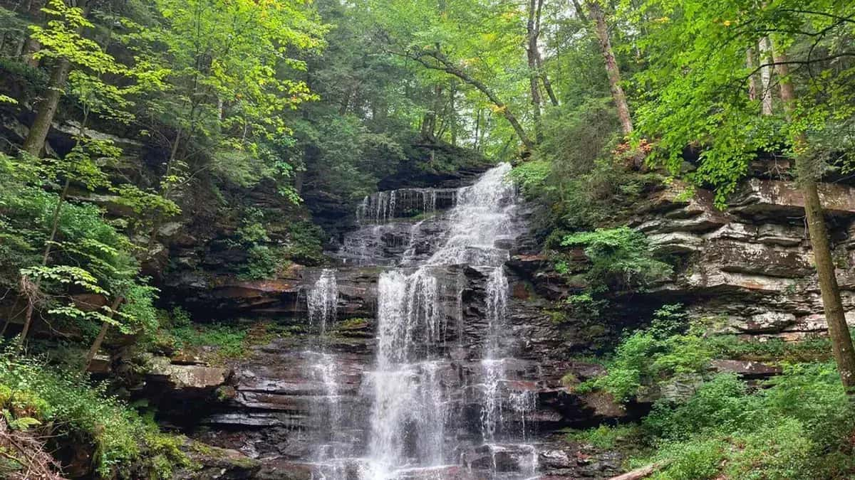
Ricketts Glen State Park is home to Pennsylvania’s most famous waterfall hike. The Falls Trail is a 7.2-mile loop with 21 named waterfalls. Ganoga Falls drops 94 feet and is one of the tallest in the state.
On a fall weekend, the parking lot fills early. If you arrive late, you will be parking on the roadside, which adds distance to your hike before you even reach the trailhead.
The trail itself is slippery. Constant spray from the falls coats the rocks and stone steps. People slip. Drop-offs are real.
DCNR closes the Falls Trail in winter except to properly equipped ice climbers and hikers. If you arrive early and wear good boots, you will see more waterfalls in one hike than anywhere else in the state. It is a popular hike that needs a plan for parking.
The Glens Natural Area, home to the Falls Trail, is a designated National Natural Landmark featuring old-growth timber and most of the park’s 22 named waterfalls. Visit the PA DCNR site for trail closures and check AllTrails for current conditions.
The Falls Trail (The Main Event)
The Numbers
- Distance: 7.2 miles (full loop) or 3.2 miles (shorter loop)
- Elevation Gain: ~1,000 feet
- Difficulty: Moderate to strenuous
- Waterfalls: 22 named in the park, 21 of them on the Falls Trail along Kitchen Creek. The 22nd, Adams Falls, is on a separate short trail from the Evergreen parking area
- Ganoga Falls: 94 feet (tallest in the park, one of the tallest in PA)
The Route
The Falls Trail follows Kitchen Creek through a gorge. You’ll descend via stone steps, pass waterfalls every few hundred feet, and climb back up the other side. The loop can be done clockwise or counterclockwise. Most hikers go counterclockwise (descend via Glen Leigh, ascend via Ganoga Glen).
What to Expect
- Constant spray: Waterfalls create mist throughout the hike. Rocks are wet year-round due to splash zone
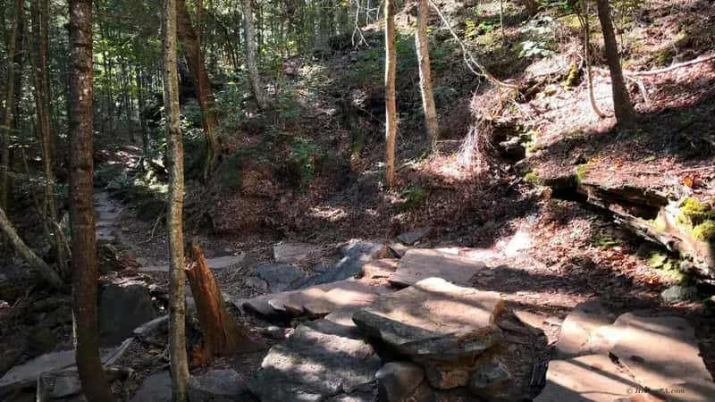
- Stone steps: Hundreds of stone steps built in the 1930s-1950s, some uneven and polished by millions of footsteps
- Drop-offs: Significant elevation changes as the trail descends into and climbs out of the gorge. Stay on marked paths, stepping off-trail can be fatal
- Crowds: Popular on weekends. Peak crowds hit between 10 AM-2 PM on Saturdays and Sundays (especially October). You’ll share the trail with hundreds of hikers in peak season
- Slipperiness: This is the primary hazard. Even “dry-looking” rocks are slick from constant mist. Trekking poles and sturdy boots are mandatory.
- Hiking Pace: Allow 3-4 hours for an experienced hiker. Beginners or those stopping frequently for photos should budget 4-5 hours
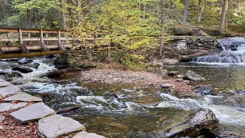
- Water Hazards: Kitchen Creek is beautiful but cold. Several trail sections cross tributary streams where logs and rocks create trip hazards after rain
- Fitness Level: The loop is 7.2 miles with 1,000 feet of elevation gain. This is “moderately strenuous” for anyone with basic hiking fitness. There is no easy version, even the shorter loop is still technically challenging
The Waterfalls (What You’re Here For)
Ganoga Falls (The Star)
94 feet. The tallest waterfall in the park. Located in Ganoga Glen. It’s the photo everyone wants.
The Full List (21 Named Waterfalls)
In order along the trail:
- Glen Leigh (counterclockwise): Mohawk, Oneida, Cayuga, Ganoga, Seneca, Delaware, Mohican, Conestoga, Tuscarora, Erie
- Ganoga Glen (counterclockwise): Harrison Wright, Sheldon Reynolds, Murray Reynolds
- Waters Meet (junction)
- Glen Leigh (clockwise): Wyandot, B. Reynolds, R.B. Ricketts, Ozone, Huron, Shawnee, F.L. Ricketts, Onondaga
Shorter Loop Option
If you don’t want to do the full 7.2 miles, take the shorter loop. DCNR describes a 3.2-mile loop (using the Highland Trail and the Glen Leigh and Ganoga Glen sides) that sees most of the waterfalls.
Parking (The Real Challenge)
Parking is the hardest part of visiting Ricketts Glen. The park doesn’t accept reservations, and lots fill based on first-come, first-served. On peak weekends, gridlock is real.
Lake Rose Parking Lot (Main Lot)
This is the closest and most convenient lot to the Falls Trail trailhead.
When it Fills: Early on weekends in April-May and October (peak foliage).
Best Arrival Times:
- Summer and fall weekends: Arrive early
- Weekdays: Much quieter, and the lot rarely fills completely
- Avoid: Midday on any Saturday or Sunday in October, this is peak gridlock
What to Expect: The lot has portable toilets and a small information kiosk. No services beyond that.
Beach Lot Overflow Parking
If Lake Rose is full, Beach Lot is the official overflow area.
Distance: DCNR lists Beach Parking Lot #2 as about a 15-20 minute walk from the Falls Trail, reached from the end of the main park road
Added Hike: Plan on that walk each way, on top of the hike
When to Use: As a last resort. Only use this if Lake Rose is full and you don’t mind the extra miles
Roadside Parking
You can park along Beach Lake Highway if both lots are full, but parking is illegal in many spots.
Reality Check: On peak October weekends (especially Columbus Day weekend), even roadside spots fill up. Arriving late means you might spend a long time circling looking for any parking spot.
Tip: If you arrive late on a weekend, consider skipping the Falls Trail and hiking a different park (Hickory Run, Hawk Mountain) instead. The parking situation isn’t worth the frustration.
Parking Strategy
Best Strategy: Arrive early on a weekend, or come on a weekday morning. Both give you better odds of parking and a much better hiking experience (fewer crowds).
Worst Strategy: Arrive midday on a Saturday or Sunday, especially in October. You will spend more time looking for parking than hiking.
Safety (This Is Not Optional)
It’s Slippery
The trail is wet year-round due to constant spray from waterfalls. Rocks and stone steps are slick. People slip and get injured.
Gear You Need
- Sturdy hiking boots: Required. No sneakers.
- Trekking poles: Highly recommended for stability on wet rocks.
- Water: Bring at least 1 liter.
Drop-Offs
The trail runs along the gorge. There are significant drop-offs. Stay on marked paths. Watch your footing.
Winter Closure
DCNR says the Falls Trail is closed in winter except to properly equipped ice climbers and hikers, and it publishes no fixed dates there. Call the park at 570-477-5675 before a cold-season trip. For ice climbing, DCNR lists crampons, ice axes and rope as minimum equipment, and requires signing in and out at the park office.
Tips for Beating the Crowds
Arrive early: Arrive early on any day of the week and you’ll have the trail much quieter. Weekdays are much quieter than weekends, if you have flexibility, a Wednesday morning in October is the best bet.
The Off-Season Strategy: Spring (late April-early May) before Memorial Day gets heavy water from snowmelt but fewer crowds than peak October. You get the drama of full waterfalls with half the hikers. September 1-24 is also excellent, good foliage and far fewer people than October 1-31.
The Loop Direction: Most people go counterclockwise (descend Glen Leigh, ascend Ganoga Glen). This works fine. However, try going clockwise some time, you’ll encounter fewer people on this less-popular route.
The Shorter Loop Option: The 3.2-mile loop is a legitimate choice. DCNR says it sees most of the waterfalls. Don’t feel like you need the full 7.2 miles.
Photography Stops: Each major waterfall has a “designated photo spot” where the trail widens slightly. Learn these locations and plan your shots. In peak season, you’ll spend more time waiting for clear shots than actually hiking.
Safety Reality Check: Slippery rocks claim injuries every single year. Wear trekking poles, this single piece of gear prevents more accidents than any other. Sturdy hiking boots (not sneakers) are non-negotiable.
If you slip on a wet rock and fall, you can hit your head on another rock. This is not hypothetical.
Photography Tips
Ganoga Falls (The Money Shot): This is the 94-foot waterfall. Shoot it from the base looking up with a wide-angle lens (16-35mm). Best light is early morning (7-9 AM) with the sun behind you creating a halo effect around the water. Overcast days eliminate harsh shadows.
Spring (April-May) offers maximum water volume. The key is arriving early so you can shoot without crowds in your frame.
Kitchen Creek Cascade: The sequential waterfalls along Kitchen Creek create natural photo opportunities. Shoot from below using slow shutter speed (1-2 seconds) to blur the water and create a silky effect. The best cascades are at mile 1-2 of the Glen Leigh descent (counterclockwise). Visit in spring (April-May) for peak water flow.
The Forest Canopy: Ricketts Glen’s old-growth hemlocks and hardwoods create a cathedral-like atmosphere. Shoot upward through the canopy to capture the scale of the trees. Cloudy days are ideal, the even light prevents harsh shadows. Fall foliage (September 25-October 15) adds color to the canopy shots.
The Overall Loop: Shoot from the observation areas at Waters Meet junction. Wide-angle lens captures the gorge depth. Late afternoon (3-5 PM) creates dramatic side-lighting on the rocky walls. Fall foliage provides a colorful background.
Icicle Photography (Winter): If you’re photographing in early winter (December), if the trail is open, the waterfalls freeze into dramatic ice formations. Shoot with a fast shutter speed to freeze falling ice crystals. Early morning light is essential for capturing the crystalline detail.
Other Trails in the Park
The park has 26 miles of trails (DCNR). Beyond the Falls Trail:
| Trail | Length | DCNR rating | Notes |
|---|---|---|---|
| Evergreen Trail | 1.0 mi loop | Easiest | From the Evergreen parking area down to Adams Falls, the park’s 22nd named falls. Kid-friendly signs. |
| Beach Trail | 0.8 mi | Easiest | Along the south shore of Lake Jean |
| Bear Walk Trail | 1.0 mi | Easiest | Links the Lake Rose trailhead with Beach Lot #2 |
| Laurel View Trail | 1.9 mi loop | Easiest | Up the fire tower road to Red Rock Mountain, the park’s high point. The tower is closed to the public. |
| Highland Trail | 1.2 mi | More difficult | Connects the two glens across the Midway Crevasse; part of the 3.2-mile falls loop |
| Old Beaver Dam Road Trail | 4.0 mi loop | More difficult | Rolling forest and stream loop from a small lot on Route 487 |
| Cherry Run Trail | 4.6 mi | More difficult | Past the old Lake Leigh dam and old logging railroad grades |
| Mountain Springs Trail | 4.0 mi | More difficult | Past the Lake Leigh dam along Bowmans Creek |
| Old Bulldozer Road Trail | 2.9 mi | Most difficult | Steep climb from the Glens lot toward Valley View Vista |
Lake Jean (The Other Side of the Park)
Swimming
A 600-foot beach, open late May to mid-September, 8 AM to sunset. Swim only in the marked area, at your own risk. The beach area is smoke-free. A food concession and picnic facilities are nearby (DCNR).
Boating
Lake Jean covers 245 acres. Electric motors only, at slow, no-wake speed. There are two launches. In summer the rental concession usually runs daily from 10 AM to 6 PM, with rowboats, paddleboats, kayaks, canoes and paddleboards. Non-powered boats need a registration or a state park or Fish and Boat Commission launch permit (DCNR).
Camping and Cabins
The park has a campground on Lake Jean, plus modern cabins and cottages; Cabins F and H are ADA accessible. Pets are allowed at designated campsites for a fee, and in the Huron, Seneca and Shawnee cottages. Book through Pennsylvania State Parks reservations online or at 888-727-2757 (DCNR). Check the reservation site for current site counts and season dates.
Visiting Basics
- Address: 695 State Route 487, Benton, PA 17814
- Hours: open every day, sunrise to sunset; day-use areas close at dusk
- Fee: none for day use. Pennsylvania state parks don’t charge entry.
- Phone: 570-477-5675
- Size: 13,193 acres in Luzerne, Sullivan and Columbia counties
Best Time to Visit
- Spring (April-May): Waterfalls are fullest from snowmelt. Parking fills early on weekends.
- Summer: Waterfalls are smaller but still impressive. Lake Jean is open for swimming.
- Fall (October): Peak foliage. The most crowded time. Arrive early.
- Winter: The Falls Trail is closed except to properly equipped ice climbers and hikers (DCNR).
FAQ
How long is the Falls Trail? 7.2 miles (full loop) or 3.2 miles (shorter loop).
How many waterfalls? 22 named waterfalls in the park: 21 along the Falls Trail, plus Adams Falls on the Evergreen Trail (DCNR).
Is it dangerous? It can be. Slippery rocks, drop-offs. Wear good boots and watch your footing.
When should I arrive? Before 8 AM on weekends (especially October). Weekdays are much quieter.
Is there an entrance fee? No. Day use is free. Camping and cabins cost extra.
What is the address? 695 State Route 487, Benton, PA 17814. Open sunrise to sunset.
Can you swim at Ricketts Glen? Yes, at the Lake Jean beach, late May to mid-September. Not in the falls.
What are the easier trails? The Evergreen Trail (1 mile, to Adams Falls), the Beach Trail and the Laurel View Trail are all rated easiest by DCNR.
Is the trail open in winter? DCNR says it is closed in winter except to properly equipped ice climbers and hikers, and publishes no fixed dates. Call 570-477-5675.
Explore More
Ricketts Glen has the most waterfalls of any hike in Pennsylvania. The Falls Trail draws large crowds, so arrive early.
Compare to Nearby Parks:
- Hickory Run State Park (about 1 hr 45 min): Boulder Field and Hawk Falls. Fewer crowds, different geology, easier hikes
- Delaware Water Gap (about 2 hr 15 min): Larger park with more trail options, but fewer waterfalls
- Promised Land State Park (about 2 hr 15 min): Lake camping and flat woodland trails
Regional Guides:
- Full Poconos region guide for more waterfall and hiking options
- PA Grand Canyon for gorge hiking in Sullivan County
- PA State Parks complete list for other ideas across the state
Similar Waterfall Experiences:
- Ohiopyle State Park in the Laurel Highlands: Walk-behind plunges like Cucumber Falls and botanical hikes on the Ferncliff Peninsula
- McConnells Mill State Park: Gorge hiking and historic covered bridge in western PA
- World’s End State Park: Canyon Vista overlook and Loyalsock Trail in Sullivan County (quieter alternative)
Hiking Trails in Ricketts Glen: 22 Waterfalls, Slippery Rocks, and No Parking
1 Guides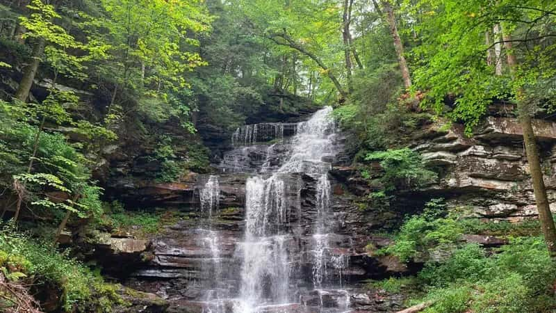
Falls Trail at Ricketts Glen: The Complete Hiker's Guide
Counter-clockwise route, 21 named waterfalls, and the 3.2-mile shortcut. How to hike Pennsylvania's best waterfall trail without ending up in a rescue story.